Geolocate

McLaurin topographic map

Click on the map to display elevation.

About this map

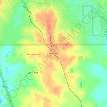
Name: McLaurin topographic map, elevation, terrain.

Location: McLaurin, Forrest County, Mississippi, 39407, United States (31.14796 -89.23728 31.18796 -89.19728)

Average elevation: 92 m

Minimum elevation: 65 m

Maximum elevation: 119 m

Other topographic maps

Click on a map to view its topography, its elevation and its terrain.

Petal

United States > Mississippi > Forrest County

Average elevation: 57 m

Petal

United States > Mississippi > Forrest County

Average elevation: 57 m

Petal

United States > Mississippi > Forrest County

Average elevation: 57 m

Ashe Lake

United States > Mississippi > Forrest County

Average elevation: 79 m

Gear up for your next adventure:

🧊Insulated Water Bottle - Keeps drinks cold in summer and prevents freezing in winter
🧦Hiking Liner Socks - Thin base layer to prevent friction and blisters
🛶Kayak Dry Bag - Waterproof storage for kayaking adventures
🥾Trekking Boots - Durable boots for long-distance trekking
🦯Trekking Poles - Reduced impact on joints for steep topographic climbs

As an Amazon Associate, this site earns from qualifying purchases at no extra cost to you.