Geolocate

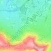
Henleaze Lake topographic map

Click on the map to display elevation.

About this map

Name: Henleaze Lake topographic map, elevation, terrain.

Location: Henleaze Lake, Southmead, Bristol, City of Bristol, West of England, England, United Kingdom (51.49460 -2.60584 51.49791 -2.60295)

Average elevation: 66 m

Minimum elevation: 23 m

Maximum elevation: 90 m

Other topographic maps

Click on a map to view its topography, its elevation and its terrain.

The Arches

United Kingdom > England > City of Bristol > Bristol

Average elevation: 50 m

Gear up for your next adventure:

🧢Sun Hat - Wide-brim hat for sun protection
🦌Outdoor Trail Camera - Monitor wildlife activity near your favorite spots
🚲Heavy Duty Bike Lock - Secure your bike at the trailhead or during stops
🥾Approach Boots - Comfortable boots for hiking and climbing approaches
🦶Anti-Blister Balm - Prevents friction and hotspots during long ascents

As an Amazon Associate, this site earns from qualifying purchases at no extra cost to you.