
Alpine topographic map
Click on the map to display elevation.
Alpine
Alpine sits on both sides of Interstate 8 at the eastern extent of the California coastal region and the western extent of the Peninsular Ranges, about 30 miles (48 km) east of downtown San Diego, at an elevation of about 2,000 feet (610 m).
About this map
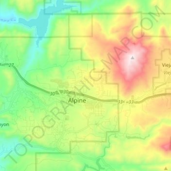
Name: Alpine topographic map, elevation, terrain.
Location: Alpine, San Diego County, California, 91901, United States (32.79892 -116.81959 32.88910 -116.69466)
Average elevation: 581 m
Minimum elevation: 170 m
Maximum elevation: 1,272 m