Geolocate

Dunnellon topographic map

Click on the map to display elevation.

About this map

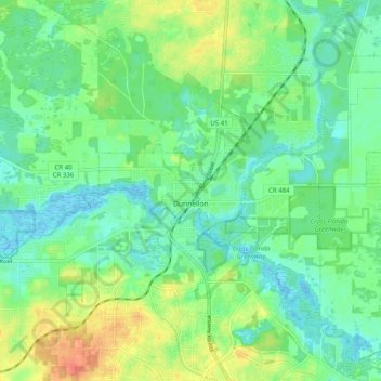
Name: Dunnellon topographic map, elevation, terrain.

Location: Dunnellon, Marion County, Florida, United States (29.02127 -82.48511 29.08295 -82.38533)

Average elevation: 21 m

Minimum elevation: 3 m

Maximum elevation: 57 m

Other topographic maps

Click on a map to view its topography, its elevation and its terrain.

Salt Springs

United States > Florida > Marion County

Average elevation: 9 m

Gear up for your next adventure:

🧤Rechargeable Heated Gloves - Extreme warmth for Canadian winter expeditions
🏃Hydration Running Vest - Carry water and maps close to your body for speed
🎒Hiking Daypack - Lightweight and durable backpacks for day trips and excursions
🔦LED Headlamp - Hands-free lighting for early morning starts or late finishes
💡Solar Camping Lamp - Eco-friendly lighting for campsites

As an Amazon Associate, this site earns from qualifying purchases at no extra cost to you.