Geolocate

Ponce Inlet topographic map

Click on the map to display elevation.

About this map

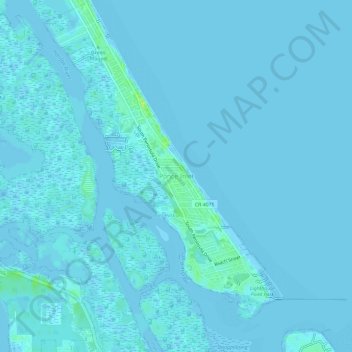
Name: Ponce Inlet topographic map, elevation, terrain.

Location: Ponce Inlet, Volusia County, Florida, United States (29.07046 -80.97531 29.12218 -80.91973)

Average elevation: 1 m

Minimum elevation: -2 m

Maximum elevation: 15 m

Other topographic maps

Click on a map to view its topography, its elevation and its terrain.

Mound Grove

United States > Florida > Volusia County

Average elevation: 3 m

Kalamazoo

United States > Florida > Volusia County

Average elevation: 7 m

Ariel

United States > Florida > Volusia County > Oak Hill

Average elevation: 3 m

Cedar Island

United States > Florida > Volusia County

Average elevation: 3 m

DeLeon Spring

United States > Florida > Volusia County

Average elevation: 12 m

Tomoka Basin

United States > Florida > Volusia County

Average elevation: 1 m

Seville

United States > Florida > Volusia County

Average elevation: 13 m

Osteen

United States > Florida > Volusia County

Average elevation: 12 m

Louise Lake

United States > Florida > Volusia County > Deltona

Average elevation: 11 m

Barberville

United States > Florida > Volusia County

Average elevation: 12 m

Deltona

United States > Florida > Volusia County > Deltona

Average elevation: 12 m

Cassadaga

United States > Florida > Volusia County

Average elevation: 20 m

Glencoe

United States > Florida > Volusia County > Glencoe

Average elevation: 8 m

Gear up for your next adventure:

🥾Hiking Leggings - Comfortable leggings for outdoor activities
🏃Hydration Running Vest - Carry water and maps close to your body for speed
🧥Waterproof Hiking Jacket - Protect yourself from rain and wind while hiking
🛶Waterproof Dry Bags - Keep electronics and clothes dry during river crossings
🚲Heavy Duty Bike Lock - Secure your bike at the trailhead or during stops

As an Amazon Associate, this site earns from qualifying purchases at no extra cost to you.