Geolocate

Leesville topographic map

Click on the map to display elevation.

About this map

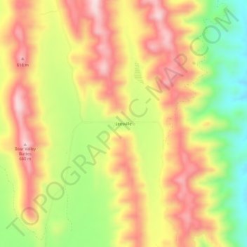
Name: Leesville topographic map, elevation, terrain.

Location: Leesville, Colusa County, California, United States (39.16933 -122.44359 39.20933 -122.40359)

Average elevation: 474 m

Minimum elevation: 272 m

Maximum elevation: 639 m

Other topographic maps

Click on a map to view its topography, its elevation and its terrain.

Williams

United States > California > Colusa County

Average elevation: 26 m

Gear up for your next adventure:

🩹Moleskin Blister Pads - Direct protection for painful foot pressure points
💡Compact LED Flashlight - Powerful and portable flashlight for outdoor use
🧥Waterproof Pants - Keep dry during rainy hiking conditions
🧭GPS Tracker - Track your location in remote areas safely
🧥Packable Rain Jacket - Breathable waterproof layer for unpredictable weather

As an Amazon Associate, this site earns from qualifying purchases at no extra cost to you.