
Olivet topographic map
Click on the map to display elevation.
About this map
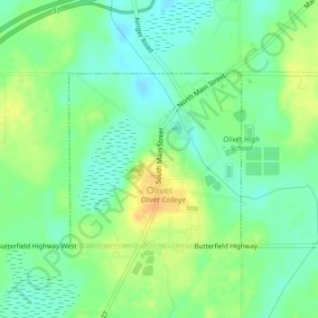
Name: Olivet topographic map, elevation, terrain.
Location: Olivet, Eaton County, Michigan, United States (42.43669 -84.93462 42.45130 -84.91474)
Average elevation: 275 m
Minimum elevation: 262 m
Maximum elevation: 293 m
Other topographic maps
Click on a map to view its topography, its elevation and its terrain.
Grand Ledge
United States > Michigan > Eaton County > Grand Ledge > Grand Ledge
Average elevation: 259 m