Geolocate

El Pital topographic map

Click on the map to display elevation.

About this map

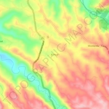
Name: El Pital topographic map, elevation, terrain.

Location: El Pital, Caldonó, Norte, Cauca, RAP Pacífico, Colombia (2.83679 -76.56178 2.87679 -76.52178)

Average elevation: 1,435 m

Minimum elevation: 1,300 m

Maximum elevation: 1,536 m

Other topographic maps

Click on a map to view its topography, its elevation and its terrain.

Río Mondomo

Colombia > Cauca > Caldonó

Average elevation: 2,129 m

Gear up for your next adventure:

🧴Waterproofing Spray - Restore the DWR coating on jackets and tents
🛌Down Sleeping Bag - Superior warmth-to-weight ratio for cold nights
🕶️Polarized Sunglasses - Reduces glare from snow and water at high elevations
🔪Outdoor Multitool - Versatile tool for repairs and food prep in the wild
🏃Hydration Running Vest - Carry water and maps close to your body for speed

As an Amazon Associate, this site earns from qualifying purchases at no extra cost to you.