Geolocate

Arlington topographic map

Click on the map to display elevation.

About this map

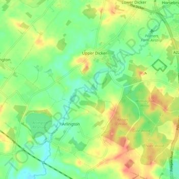
Name: Arlington topographic map, elevation, terrain.

Location: Arlington, Wealden, East Sussex, England, United Kingdom (50.82972 0.16777 50.88222 0.24328)

Average elevation: 21 m

Minimum elevation: 2 m

Maximum elevation: 45 m

Gear up for your next adventure:

Family Camping Tent - Spacious tent suitable for family camping trips
🥾Light Hiking Boots - Lightweight and comfortable boots for day hikes
🧼Biodegradable Camp Soap - Environmentally friendly cleaning for gear and body
🛶Waterproof Dry Bags - Keep electronics and clothes dry during river crossings
🎒Backpack Rain Cover - External shield to keep your entire pack dry

As an Amazon Associate, this site earns from qualifying purchases at no extra cost to you.