
Ichhawar Tahsil topographic map
Interactive map
Click on the map to display elevation.
About this map
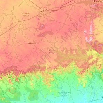
Name: Ichhawar Tahsil topographic map, elevation, terrain.
Location: Ichhawar Tahsil, Sehore, Madhya Pradesh, 466115, India (22.82342 76.83552 23.14235 77.44499)
Average elevation: 459 m
Minimum elevation: 293 m
Maximum elevation: 652 m
Other topographic maps
Click on a map to view its topography, its elevation and its terrain.
Kolar
India > Madhya Pradesh > Ichhawar Tahsil
Kolar, Ichhawar Tahsil, Sehore, Madhya Pradesh, 466115, India
Average elevation: 376 m