
Bethersden topographic map
Click on the map to display elevation.
About this map
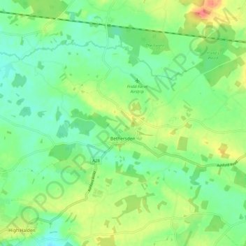
Name: Bethersden topographic map, elevation, terrain.
Location: Bethersden, Ashford, Kent, England, United Kingdom (51.10659 0.70722 51.15573 0.80834)
Average elevation: 38 m
Minimum elevation: 18 m
Maximum elevation: 72 m
Other topographic maps
Click on a map to view its topography, its elevation and its terrain.