Geolocate

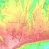
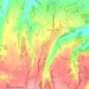
Northfleet topographic map

Click on the map to display elevation.

About this map

Name: Northfleet topographic map, elevation, terrain.

Location: Northfleet, Gravesham, Kent, England, United Kingdom (51.39348 0.31066 51.46934 0.37343)

Average elevation: 33 m

Minimum elevation: -7 m

Maximum elevation: 105 m

Other topographic maps

Click on a map to view its topography, its elevation and its terrain.
Lower Higham

United Kingdom > England > Kent > Gravesham

Average elevation: 28 m

Istead Rise

United Kingdom > England > Kent > Gravesham

Average elevation: 63 m

Robins Creek

United Kingdom > England > Kent > Gravesham > Northfleet

Average elevation: 10 m

Little Hermitage

United Kingdom > England > Kent > Gravesham > Higham

Average elevation: 49 m

Shorne Wood

United Kingdom > England > Kent > Gravesham > Shorne Ridgeway

Average elevation: 83 m

Culverstone Green

United Kingdom > England > Kent > Gravesham

Average elevation: 163 m

Springhead

United Kingdom > England > Kent > Gravesham > Northfleet

Average elevation: 29 m

Chalk

United Kingdom > England > Kent > Gravesham

Average elevation: 27 m

Meopham Green

United Kingdom > England > Kent > Gravesham > Meopham

Average elevation: 130 m

Gore Green

United Kingdom > England > Kent > Gravesham > Lower Higham

Average elevation: 22 m

Vigo Village

United Kingdom > England > Kent > Gravesham

Average elevation: 144 m

Henhurst

United Kingdom > England > Kent > Gravesham > Cobham

Average elevation: 78 m

Luddesdown

United Kingdom > England > Kent > Gravesham > Luddesdown

Average elevation: 96 m

Gear up for your next adventure:

🥾Waterproof Hiking Boots - Boots keeping your feet dry in wet conditions
🧊Portable Cooler - Keep food and drinks cold during outdoor adventures
🥾Durable Hiking Shoes - Long-lasting shoes for frequent hiking
🧢Hiking Hat - Sun-protective and breathable hats for long treks
🧢Sun Hat - Wide-brim hat for sun protection

As an Amazon Associate, this site earns from qualifying purchases at no extra cost to you.