Geolocate

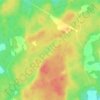
Hishult topographic map

Click on the map to display elevation.

About this map

Name: Hishult topographic map, elevation, terrain.

Location: Hishult, Laholms kommun, Halland County, 310 21, Sweden (56.40825 13.29220 56.44825 13.33220)

Average elevation: 102 m

Minimum elevation: 75 m

Maximum elevation: 138 m

Other topographic maps

Click on a map to view its topography, its elevation and its terrain.
Hallandsåsen

Sweden > Halland County

Average elevation: 70 m

Fäberga naturreservat

Sweden > Halland County > Halmstad > Ryd

Average elevation: 38 m

Kungsbacka kommun

Sweden > Halland County

Average elevation: 41 m

Hylte kommun

Sweden > Halland County

Average elevation: 145 m

Laholms kommun

Sweden > Halland County

Average elevation: 98 m

Gällarpesjön

Sweden > Halland County

Average elevation: 104 m

Halmstads kommun

Sweden > Halland County

Average elevation: 65 m

Vendelsö

Sweden > Halland County

Average elevation: 2 m

Bocksjö

Sweden > Halland County

Average elevation: 75 m

Varbergs kommun

Sweden > Halland County

Average elevation: 35 m

Gear up for your next adventure:

🔭Compact Monocular - One-handed bird watching and trail spotting
⛺Lightweight Backpacking Tent - Compact tent for efficient hiking trips
⛺Lightweight Camping Tent - Portable shelter optimized for Canadian backcountry camping
🧥Packable Rain Jacket - Breathable waterproof layer for unpredictable weather
🧭GPS Handheld Device - Reliable GPS navigation for outdoor adventures

As an Amazon Associate, this site earns from qualifying purchases at no extra cost to you.