Geolocate

Naples topographic map

Click on the map to display elevation.

About this map

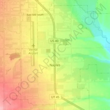
Name: Naples topographic map, elevation, terrain.

Location: Naples, Uintah County, Utah, United States (40.40970 -109.52321 40.45263 -109.46103)

Average elevation: 1,595 m

Minimum elevation: 1,530 m

Maximum elevation: 1,660 m

Other topographic maps

Click on a map to view its topography, its elevation and its terrain.

Mollys Nipple

United States > Utah > Uintah County

Average elevation: 1,440 m

Green River

United States > Utah > Uintah County

Average elevation: 1,576 m

Green River

United States > Utah > Uintah County

Average elevation: 1,431 m

Green River

United States > Utah > Uintah County

Average elevation: 1,500 m

Lapoint

United States > Utah > Uintah County

Average elevation: 1,710 m

Steinaker Reservoir

United States > Utah > Uintah County

Average elevation: 1,690 m

Jensen

United States > Utah > Uintah County

Average elevation: 1,470 m

Gear up for your next adventure:

🥾Approach Shoes - Shoes designed for climbing approaches and rugged trails
🔦LED Flashlight - Powerful and long-lasting flashlight for camping and emergencies
💧Collapsible Water Bottle - Space-saving water bottle for outdoor activities
🌡️Emergency Mylar Blankets - Compact thermal protection for unexpected nights outdoors
🧭GPS Handheld Device - Reliable GPS navigation for outdoor adventures

As an Amazon Associate, this site earns from qualifying purchases at no extra cost to you.