
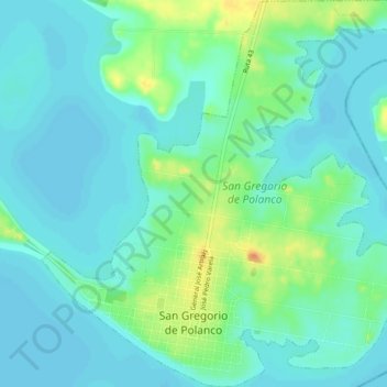
San Gregorio de Polanco topographic map
Interactive map
Click on the map to display elevation.
About this map
Name: San Gregorio de Polanco topographic map, elevation, terrain.
Location: San Gregorio de Polanco, Tacuarembó, 45200, Uruguay (-32.62430 -55.85210 -32.58667 -55.80909)
Average elevation: 83 m
Minimum elevation: 73 m
Maximum elevation: 110 m
Other topographic maps
Click on a map to view its topography, its elevation and its terrain.