Geolocate

Kota Tinggi topographic map

Click on the map to display elevation.

About this map
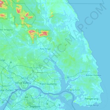
Name: Kota Tinggi topographic map, elevation, terrain.

Location: Kota Tinggi, Johor, Malaysia (1.33682 103.55108 2.04543 104.29836)

Average elevation: 29 m

Minimum elevation: -5 m

Maximum elevation: 623 m

Other topographic maps

Click on a map to view its topography, its elevation and its terrain.
FELDA Taib Andak

Malaysia > Johor

Average elevation: 50 m

Tenang Stesen

Malaysia > Johor > Kampung Sawah Padi

Average elevation: 41 m

Gear up for your next adventure:

☕Camping Coffee Maker - Brew fresh coffee anywhere on the topographic map
👟Leg Gaiters - Keep debris, mud, and snow out of your boots
🛶Canoe Life Vest - Safety vest for water sports
🪑Insulated Seat Pad - Protect your seat from cold rocks and wet logs
🧤Thermal Hiking Gloves - Grip-enhanced gloves for cold-weather altitude trekking

As an Amazon Associate, this site earns from qualifying purchases at no extra cost to you.