Geolocate

Trödje topographic map

Click on the map to display elevation.

About this map

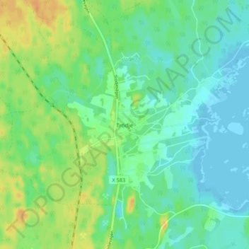
Name: Trödje topographic map, elevation, terrain.

Location: Trödje, Gävle kommun, Gävleborg County, 805 96, Sweden (60.79896 17.19457 60.83896 17.23457)

Average elevation: 11 m

Minimum elevation: -1 m

Maximum elevation: 30 m

Other topographic maps

Click on a map to view its topography, its elevation and its terrain.

Gran

Sweden > Gävleborg County > Gnarp District

Average elevation: 0 m

Ljusdals kommun

Sweden > Gävleborg County

Average elevation: 315 m

Disan

Sweden > Gävleborg County

Average elevation: 43 m

Hamra

Sweden > Gävleborg County

Average elevation: 437 m

Hamra

Sweden > Gävleborg County

Average elevation: 437 m

Hamra

Sweden > Gävleborg County

Average elevation: 437 m

Söderhamns kommun

Sweden > Gävleborg County

Average elevation: 67 m

Gävle

Sweden > Gävleborg County

Average elevation: 28 m

Gnarp District

Sweden > Gävleborg County

Average elevation: 32 m

Hudiksvalls kommun

Sweden > Gävleborg County

Average elevation: 95 m

Gävle kommun

Sweden > Gävleborg County

Average elevation: 61 m

Ovanåkers kommun

Sweden > Gävleborg County

Average elevation: 269 m

Hofors kommun

Sweden > Gävleborg County

Average elevation: 147 m

Gear up for your next adventure:

🧥Fleece Jacket - Warm and lightweight jacket for layering
Backpacking Tent - Lightweight tent for long-distance hiking trips
🧢Hiking Hat - Sun-protective and breathable hats for long treks
🦌Outdoor Trail Camera - Monitor wildlife activity near your favorite spots
🔦LED Headtorch - Bright and durable light for night activities

As an Amazon Associate, this site earns from qualifying purchases at no extra cost to you.