Geolocate

Corsley topographic map

Click on the map to display elevation.

About this map

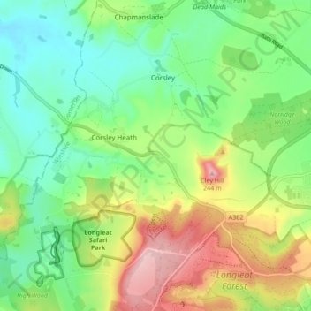
Name: Corsley topographic map, elevation, terrain.

Location: Corsley, Corsley Heath, Wiltshire, England, United Kingdom (51.18536 -2.28841 51.22614 -2.20387)

Average elevation: 137 m

Minimum elevation: 71 m

Maximum elevation: 249 m

Other topographic maps

Click on a map to view its topography, its elevation and its terrain.

Longhedge

United Kingdom > England > Wiltshire > Corsley Heath

Average elevation: 152 m

Gear up for your next adventure:

🧦Crew Hiking Socks - Comfortable socks for long-distance hikes
🧢Beanie Hat - Keep your head warm in cold weather
🪜Heavy Duty Carabiners - Multi-use clips for securing gear to your backpack
🧭GPS Handheld Device - Reliable GPS navigation for outdoor adventures
Family Camping Tent - Spacious tent suitable for family camping trips

As an Amazon Associate, this site earns from qualifying purchases at no extra cost to you.