Geolocate

Wrangle topographic map

Click on the map to display elevation.

About this map

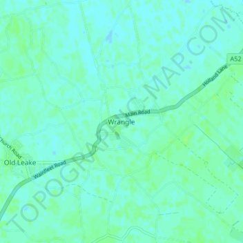
Name: Wrangle topographic map, elevation, terrain.

Location: Wrangle, Boston, Lincolnshire, England, PE22 9AL, United Kingdom (53.01787 0.10476 53.05787 0.14476)

Average elevation: 3 m

Minimum elevation: 0 m

Maximum elevation: 7 m

Other topographic maps

Click on a map to view its topography, its elevation and its terrain.

Kirton CP

United Kingdom > England > Lincolnshire > Boston

Average elevation: 4 m

Frampton CP

United Kingdom > England > Lincolnshire > Boston

Average elevation: 4 m

Gear up for your next adventure:

🔥Camping Stove - Portable stoves to cook outdoors with ease
📷Outdoor Action Camera - Capture high-elevation views and rugged adventures
🧶550 Survival Paracord - Versatile utility cord for emergency repairs and rigging
Tent Footprint - Protect tent floor and increase durability
🥾Lightweight Hiking Shoes - Comfortable shoes for day hikes

As an Amazon Associate, this site earns from qualifying purchases at no extra cost to you.