

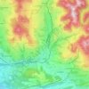
Steg topographic map
Click on the map to display elevation.
About this map

Name: Steg topographic map, elevation, terrain.
Location: Steg, Fischenthal, Bezirk Hinwil, Zurich, 8496, Switzerland (47.33141 8.91514 47.37141 8.95514)
Average elevation: 836 m
Minimum elevation: 664 m
Maximum elevation: 1,122 m
Other topographic maps
Click on a map to view its topography, its elevation and its terrain.

Wald (ZH)
Switzerland > Zurich > Bezirk Hinwil
At the turn of the 19th and 20th centuries, there were 16 factories in Wald, all of which made their money from textiles. At this time, Wald was also known as the "Manchester of the Canton of Zurich". In the 1860s, the Oberholzer family of factory owners promoted social welfare by establishing workers' housing…
Average elevation: 790 m
