Geolocate

Oldbury topographic map

Click on the map to display elevation.

About this map

Name: Oldbury topographic map, elevation, terrain.

Location: Oldbury, Ightham, Tonbridge and Malling, Kent, England, TN15 9DH, United Kingdom (51.26601 0.25335 51.30601 0.29335)

Average elevation: 120 m

Minimum elevation: 50 m

Maximum elevation: 204 m

Other topographic maps

Click on a map to view its topography, its elevation and its terrain.
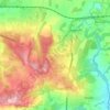
Ightham

United Kingdom > England > Kent > Tonbridge and Malling > Ightham

Average elevation: 121 m

Gear up for your next adventure:

🧤Insulated Winter Gloves - Heavy-duty protection for sub-zero Canadian adventures
🥾Mountain Trail Shoes - High-traction shoes for mountain trails
🥾Hiking Shoes - Durable and comfortable shoes for trail hiking
💡LED Camping Lantern - Illuminate your campsite with long-lasting lanterns
💡Compact LED Flashlight - Powerful and portable flashlight for outdoor use

As an Amazon Associate, this site earns from qualifying purchases at no extra cost to you.