Geolocate

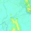
Twante topographic map

Click on the map to display elevation.

About this map

Name: Twante topographic map, elevation, terrain.

Location: Twante, Twantay Township, Twantay District, Yangon, 11331, Myanmar (16.67667 95.89333 16.75667 95.97333)

Average elevation: 8 m

Minimum elevation: -1 m

Maximum elevation: 37 m

Other topographic maps

Click on a map to view its topography, its elevation and its terrain.

U.S.A

Myanmar > Yangon > Twantay District > La Thar

Average elevation: 14 m

Kungyangon

Myanmar > Yangon > Twantay District

Average elevation: 4 m

Dala Township

Myanmar > Yangon > Twantay District

Average elevation: 4 m

Twantay Township

Myanmar > Yangon > Twantay District

Average elevation: 7 m

Twantay Township

Myanmar > Yangon > Twantay District

Average elevation: 7 m

Dala Township

Myanmar > Yangon > Twantay District

Average elevation: 4 m

Gear up for your next adventure:

🥾Waterproof Trail Shoes - Shoes designed to handle wet terrain
💧Hydration Bladder - Hands-free hydration solution for long treks
👟Trail Running Shoes - Agile footwear for fast-paced topographic exploration
🥾Trail Hiking Socks - Comfortable socks to prevent blisters and fatigue
🥾Durable Hiking Shoes - Long-lasting shoes for frequent hiking

As an Amazon Associate, this site earns from qualifying purchases at no extra cost to you.