Geolocate

Nieuwegein topographic map

Click on the map to display elevation.

About this map
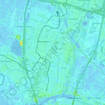
Name: Nieuwegein topographic map, elevation, terrain.

Location: Nieuwegein, Utrecht, Netherlands (51.99745 5.06251 52.06226 5.13099)

Average elevation: 2 m

Minimum elevation: -4 m

Maximum elevation: 20 m

Gear up for your next adventure:

🧳Compression Sacks - Maximize space in your backpack by shrinking gear
🔋Lithium AA Batteries - Long-lasting power that performs in extreme cold
🥾Light Trekking Boots - Supportive boots for multi-day treks
🥾Mountain Hiking Shoes - Shoes with superior grip for mountainous terrain
🥾Mountain Trail Shoes - High-traction shoes for mountain trails

As an Amazon Associate, this site earns from qualifying purchases at no extra cost to you.