Geolocate

Eembrugge topographic map

Click on the map to display elevation.

About this map

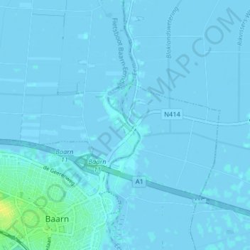
Name: Eembrugge topographic map, elevation, terrain.

Location: Eembrugge, Baarn, Utrecht, Netherlands, 3741 LB, Netherlands (52.20610 5.29099 52.24610 5.33099)

Average elevation: 1 m

Minimum elevation: -3 m

Maximum elevation: 17 m

Other topographic maps

Click on a map to view its topography, its elevation and its terrain.

Baarn

Netherlands > Utrecht > Baarn

Average elevation: 5 m

Gear up for your next adventure:

👟Sport Hiking Sandals - Breathable footwear for water crossings and camp rest
🥾Hiking Gaiters - Protect legs and shoes from mud, snow, and debris
🧤Insulated Winter Gloves - Heavy-duty protection for sub-zero Canadian adventures
🧰Multitool Knife - Compact and versatile tool for outdoor use
🧭Orienteering Kit - Tools for map reading and navigation in the wild

As an Amazon Associate, this site earns from qualifying purchases at no extra cost to you.