Geolocate

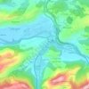
Soto topographic map

Click on the map to display elevation.

About this map

Name: Soto topographic map, elevation, terrain.

Location: Soto, Ribera de Arriba, Asturias, 33172, España (43.29271 -5.91933 43.31482 -5.87180)

Average elevation: 233 m

Minimum elevation: 112 m

Maximum elevation: 530 m

Other topographic maps

Click on a map to view its topography, its elevation and its terrain.
Soto de Ribera

España > Asturias > Ribera de Arriba

Average elevation: 229 m

Santágueda

España > Asturias > Ribera de Arriba

Average elevation: 203 m

Lugar de Abajo

España > Asturias > Ribera de Arriba

Average elevation: 251 m

Santágueda

España > Asturias > Ribera de Arriba

Average elevation: 203 m

Gear up for your next adventure:

🥫Freeze-Dried Meals - Lightweight, high-calorie nutrition for multi-day treks
⛺Backpacking Tent - Lightweight tent for long-distance hiking trips
🧰Survival Kit - Essential gear for emergencies in the wilderness
🧢Sun Protection Cap - Breathable cap to protect from sun exposure
🥤Collapsible Travel Cup - Saves space and weight in your mess kit

As an Amazon Associate, this site earns from qualifying purchases at no extra cost to you.