Geolocate

Seasalter topographic map

Click on the map to display elevation.

About this map

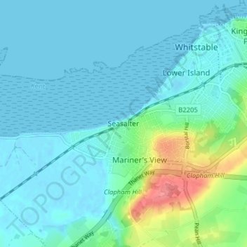
Name: Seasalter topographic map, elevation, terrain.

Location: Seasalter, Canterbury, Kent, England, CT5 4ES, United Kingdom (51.32822 0.98506 51.36822 1.02506)

Average elevation: 12 m

Minimum elevation: -2 m

Maximum elevation: 71 m

Other topographic maps

Click on a map to view its topography, its elevation and its terrain.

Littlebourne

United Kingdom > England > Kent > Canterbury

Average elevation: 21 m

Gear up for your next adventure:

🧥Thermal Layer - Insulating layer for cold outdoor conditions
💡Portable Camping Lamp - Rechargeable lamp for campsite lighting
🧶550 Survival Paracord - Versatile utility cord for emergency repairs and rigging
🦟Insect Repellent - Keep mosquitoes and black flies away in wooded areas
🎒Hiking Backpack - Lightweight and ergonomic backpacks for day hikes or multi-day treks

As an Amazon Associate, this site earns from qualifying purchases at no extra cost to you.