Geolocate

Lake Louise topographic map

Click on the map to display elevation.

About this map

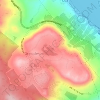
Name: Lake Louise topographic map, elevation, terrain.

Location: Lake Louise, Grindelwald, West Tamar, Tasmania, Australia (-41.34815 147.00412 -41.34511 147.00996)

Average elevation: 124 m

Minimum elevation: -2 m

Maximum elevation: 216 m

Other topographic maps

Click on a map to view its topography, its elevation and its terrain.

Cathedral Mountain

Australia > Tasmania

Average elevation: 992 m

Waterworks Reserve

Australia > Tasmania > Hobart

Average elevation: 240 m

Rowlands Hill

Australia > Tasmania

Average elevation: 388 m

Cradle Mountain

Australia > Tasmania > Cradle Mountain

Average elevation: 1,144 m

The Nut

Australia > Tasmania > Stanley

Average elevation: 8 m

Bream Creek

Australia > Tasmania > Bream Creek

Average elevation: 35 m

West Gawler River

Australia > Tasmania > Sprent > Gawler

Average elevation: 201 m

Buxton Point

Australia > Tasmania > Little Swanport

Average elevation: 3 m

Mount Patrick

Australia > Tasmania

Average elevation: 863 m

Mount Ossa

Australia > Tasmania

Average elevation: 1,218 m

Mount Tyndall

Australia > Tasmania

Average elevation: 910 m

Gear up for your next adventure:

🛰️Satellite Messenger - Emergency communication for areas with no cell service
🧼Biodegradable Camp Soap - Environmentally friendly cleaning for gear and body
🧢Outdoor Visor - Breathable visor for sunny hikes
🦯Trekking Poles - Reduced impact on joints for steep topographic climbs
🧥Fleece Jacket - Warm and lightweight jacket for layering

As an Amazon Associate, this site earns from qualifying purchases at no extra cost to you.