Geolocate

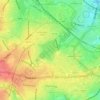
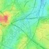
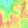
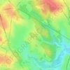
Highters Heath topographic map

Click on the map to display elevation.

About this map

Name: Highters Heath topographic map, elevation, terrain.

Location: Highters Heath, Birmingham, West Midlands, England, B14 5JP, United Kingdom (52.38514 -1.90092 52.42514 -1.86092)

Average elevation: 152 m

Minimum elevation: 122 m

Maximum elevation: 200 m

Other topographic maps

Click on a map to view its topography, its elevation and its terrain.
Sutton Park

United Kingdom > England > Birmingham > Four Oaks

Average elevation: 145 m

Sutton Coldfield

United Kingdom > England > Birmingham

Average elevation: 124 m

Lifford Reservoir

United Kingdom > England > Birmingham > Lifford

Average elevation: 150 m

Highbury Park

United Kingdom > England > Birmingham > Kings Heath

Average elevation: 142 m

Pype Hayes

United Kingdom > England > Birmingham > Tyburn

Average elevation: 104 m

North Edgbaston

United Kingdom > England > Birmingham

Average elevation: 162 m

Joy's Wood

United Kingdom > England > Birmingham > Wake Green

Average elevation: 140 m

Calthorpe Park

United Kingdom > England > Birmingham > Highgate

Average elevation: 128 m

Sutton Coldfield

United Kingdom > England > Birmingham

Average elevation: 124 m

Sutton Park

United Kingdom > England > Birmingham > Four Oaks

Average elevation: 145 m

Gear up for your next adventure:

🧢Hiking Hat - Sun-protective and breathable hats for long treks
🦯Trekking Poles - Reduced impact on joints for steep topographic climbs
🥾Trail Hiking Boots - Supportive boots for rough trails
🧦Hiking Socks - Moisture-wicking and comfortable socks for long hikes
🛁Quick-Dry Microfiber Towel - Space-saving towel that dries rapidly on the move

As an Amazon Associate, this site earns from qualifying purchases at no extra cost to you.