
Make a donation
Gear up for your next adventure:
As an Amazon Associate, this site earns from qualifying purchases at no extra cost to you.
Rolling Hills topographic map
Click on the map to display elevation.
Make a donation
Gear up for your next adventure:
As an Amazon Associate, this site earns from qualifying purchases at no extra cost to you.
About this map
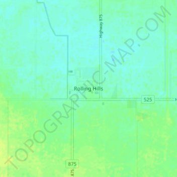
Name: Rolling Hills topographic map, elevation, terrain.
Location: Rolling Hills, County of Newell, Alberta, Canada (50.20520 -111.79293 50.24520 -111.75293)
Average elevation: 748 m
Minimum elevation: 742 m
Maximum elevation: 755 m
County of Newell trails, hiking, mountain biking, running and outdoor activities
Make a donation
Gear up for your next adventure:
As an Amazon Associate, this site earns from qualifying purchases at no extra cost to you.
Other topographic maps
Click on a map to view its topography, its elevation and its terrain.
Dinosaur Provincial Park
Canada > Alberta > County of Newell
The park is situated in the valley of the Red Deer River, which is noted for its striking badland topography. The park is well known for being one of the richest dinosaur fossil locales in the world. Fifty-eight dinosaur species have been discovered at the park and more than 500 specimens have been removed and…
Average elevation: 712 m