Geolocate

Kingwood Common topographic map

Click on the map to display elevation.

About this map

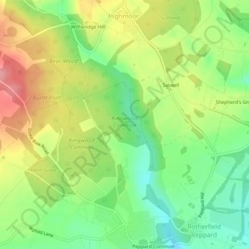
Name: Kingwood Common topographic map, elevation, terrain.

Location: Kingwood Common, Highmoor, South Oxfordshire, Oxfordshire, England, United Kingdom (51.53613 -0.99885 51.54637 -0.98424)

Average elevation: 125 m

Minimum elevation: 77 m

Maximum elevation: 184 m

Other topographic maps

Click on a map to view its topography, its elevation and its terrain.

Gear up for your next adventure:

🔦LED Flashlight - Powerful and long-lasting flashlight for camping and emergencies
Backpacking Tent - Lightweight tent for long-distance hiking trips
💧Collapsible Water Bottle - Space-saving water bottle for outdoor activities
🩹Compact First Aid Kit - Pre-packed essentials for common trail injuries
🧦Hiking Liner Socks - Thin base layer to prevent friction and blisters

As an Amazon Associate, this site earns from qualifying purchases at no extra cost to you.