Geolocate

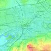
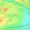
Croft topographic map

Click on the map to display elevation.

About this map

Name: Croft topographic map, elevation, terrain.

Location: Croft, Warrington, England, United Kingdom (53.42602 -2.58460 53.46150 -2.48265)

Average elevation: 27 m

Minimum elevation: 7 m

Maximum elevation: 47 m

Other topographic maps

Click on a map to view its topography, its elevation and its terrain.

Lymm

United Kingdom > England > Warrington

Average elevation: 31 m

Warrington

United Kingdom > England > Warrington

Average elevation: 20 m

Lately Common

United Kingdom > England > Warrington > Glazebury

Average elevation: 21 m

Appleton Thorn

United Kingdom > England > Warrington

Average elevation: 61 m

Arbury

United Kingdom > England > Warrington > Winwick

Average elevation: 22 m

Sankey Brook

United Kingdom > England > Warrington > Warrington

Average elevation: 12 m

Cuerdley Cross

United Kingdom > England > Warrington

Average elevation: 19 m

Diggle Green

United Kingdom > England > Warrington > Kenyon

Average elevation: 29 m

Hollins Green

United Kingdom > England > Warrington

Average elevation: 18 m

Burtonwood

United Kingdom > England > Warrington

Average elevation: 26 m

Gear up for your next adventure:

🥾Light Hiking Boots - Lightweight and comfortable boots for day hikes
🥾Waterproof Hiking Boots - Essential footwear for rugged terrain and wet Canadian trails
🧥Waterproof Jacket - Lightweight rain jackets for hiking and outdoor activities
🦶Anti-Blister Balm - Prevents friction and hotspots during long ascents
🐕Hiking Dog Pack - Let your canine companion carry their own water and food

As an Amazon Associate, this site earns from qualifying purchases at no extra cost to you.