Geolocate

Summerlin topographic map

Click on the map to display elevation.

About this map

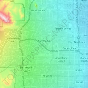
Name: Summerlin topographic map, elevation, terrain.

Location: Summerlin, Las Vegas, Clark County, Nevada, United States (36.15542 -115.40658 36.21863 -115.26006)

Average elevation: 865 m

Minimum elevation: 694 m

Maximum elevation: 1,613 m

Other topographic maps

Click on a map to view its topography, its elevation and its terrain.

Gear up for your next adventure:

🥾Hiking Shoes - Durable and comfortable shoes for trail hiking
💧Filtered Water Bottle - Safe drinking water on the go
🧥Waterproof Hiking Jacket - Protect yourself from rain and wind while hiking
🧴First Aid Kit - Essential first aid supplies for outdoor emergencies
🥾Mountain Hiking Boots - High-traction boots for rocky terrain

As an Amazon Associate, this site earns from qualifying purchases at no extra cost to you.