Geolocate

Wanlip topographic map

Click on the map to display elevation.

About this map

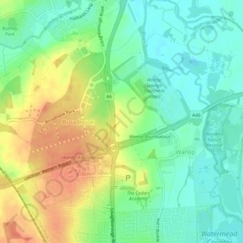
Name: Wanlip topographic map, elevation, terrain.

Location: Wanlip, Charnwood, Leicestershire, England, United Kingdom (52.68449 -1.14374 52.70590 -1.10618)

Average elevation: 63 m

Minimum elevation: 43 m

Maximum elevation: 90 m

Gear up for your next adventure:

🧢Sun Hat - Wide-brim hat for sun protection
🥾Light Hiking Boots - Lightweight and comfortable boots for day hikes
🎒Hiking Backpack - Lightweight and ergonomic backpacks for day hikes or multi-day treks
Camping Coffee Maker - Brew fresh coffee anywhere on the topographic map
👟Sport Hiking Sandals - Breathable footwear for water crossings and camp rest

As an Amazon Associate, this site earns from qualifying purchases at no extra cost to you.