Geolocate

Jeff topographic map

Click on the map to display elevation.

About this map
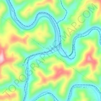
Name: Jeff topographic map, elevation, terrain.

Location: Jeff, Perry County, Kentucky, 41751, United States (37.18510 -83.15628 37.22510 -83.11628)

Average elevation: 374 m

Minimum elevation: 264 m

Maximum elevation: 575 m

Gear up for your next adventure:

🧴Waterproofing Spray - Restore the DWR coating on jackets and tents
👟Leg Gaiters - Keep debris, mud, and snow out of your boots
💡LED Headlamp - Hands-free illumination for night hiking and camping
🕯️Camping Lantern - Illuminates your entire campsite with high-efficiency LEDs
🧰Emergency Multi-Tool - Compact multi-tool for outdoor survival

As an Amazon Associate, this site earns from qualifying purchases at no extra cost to you.