Geolocate

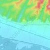
Vrginmost topographic map

Click on the map to display elevation.

About this map

Name: Vrginmost topographic map, elevation, terrain.

Location: Vrginmost, Općina Gvozd, Sisak-Moslavina County, 44410, Croatia (45.34386 15.84874 45.36537 15.88886)

Average elevation: 147 m

Minimum elevation: 120 m

Maximum elevation: 202 m

Other topographic maps

Click on a map to view its topography, its elevation and its terrain.

Paklenica

Croatia > Sisak-Moslavina County > Grad Novska

Average elevation: 133 m

Matijevići

Croatia > Sisak-Moslavina County

Average elevation: 168 m

Bobovac

Croatia > Sisak-Moslavina County

Average elevation: 94 m

Maja

Croatia > Sisak-Moslavina County > Town of Glina

Average elevation: 156 m

Gear up for your next adventure:

🛏️Sleeping Bag - Warm and compact sleeping bags for outdoor camping
🧤Insulated Winter Gloves - Heavy-duty protection for sub-zero Canadian adventures
💧Hydration Bladder - Hands-free hydration solution for long treks
🧥Thermal Fleece Jacket - Versatile insulation for changing mountain temperatures
🧭Orienteering Kit - Tools for map reading and navigation in the wild

As an Amazon Associate, this site earns from qualifying purchases at no extra cost to you.