Geolocate

Starling topographic map

Click on the map to display elevation.

About this map

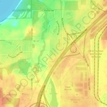
Name: Starling topographic map, elevation, terrain.

Location: Starling, Big Lake, Edmonton, Alberta, Canada (53.57844 -113.66411 53.59967 -113.65153)

Average elevation: 677 m

Minimum elevation: 650 m

Maximum elevation: 694 m

Alberta trails, hiking, mountain biking, running and outdoor activities

Other topographic maps

Click on a map to view its topography, its elevation and its terrain.

William Hawrelak Park

Canada > Alberta > Edmonton

Average elevation: 649 m

Horseshoe Lake

Canada > Alberta > Edmonton

Average elevation: 680 m

landslide

Canada > Alberta > Edmonton

Average elevation: 668 m

Ormsby Park

Canada > Alberta > Edmonton

Average elevation: 688 m

Gear up for your next adventure:

🧥Packable Rain Jacket - Breathable waterproof layer for unpredictable weather
Camping Tent - Weather-resistant tents suitable for 2 to 6 people
🧢Hiking Hat - Sun-protective and breathable hats for long treks
Tent Footprint - Protect tent floor and increase durability
🧦Hiking Liner Socks - Thin base layer to prevent friction and blisters

As an Amazon Associate, this site earns from qualifying purchases at no extra cost to you.