Geolocate

Keller topographic map

Click on the map to display elevation.

About this map
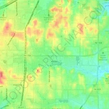
Name: Keller topographic map, elevation, terrain.

Location: Keller, Tarrant County, Texas, 76248, United States (32.89237 -97.26615 32.97857 -97.17680)

Average elevation: 213 m

Minimum elevation: 183 m

Maximum elevation: 252 m

Gear up for your next adventure:

📷Outdoor Action Camera - Capture high-elevation views and rugged adventures
🎒Fully Waterproof Backpack - Total protection for photography gear and electronics
🧤Insulated Winter Gloves - Heavy-duty protection for sub-zero Canadian adventures
🧶550 Survival Paracord - Versatile utility cord for emergency repairs and rigging
🗺️Topographic Maps - Detailed maps to explore trails, mountains, and wilderness areas

As an Amazon Associate, this site earns from qualifying purchases at no extra cost to you.