
Capreol topographic map
Interactive map
Click on the map to display elevation.
About this map
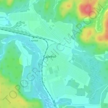
Name: Capreol topographic map, elevation, terrain.
Location: Capreol, Greater Sudbury, Ontario, Canada (46.69658 -80.93082 46.71658 -80.91082)
Average elevation: 314 m
Minimum elevation: 295 m
Maximum elevation: 368 m
Ontario trails, hiking, mountain biking, running and outdoor activities
Other topographic maps
Click on a map to view its topography, its elevation and its terrain.