Geolocate

Sudbury topographic map

Click on the map to display elevation.

About this map

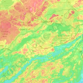
Name: Sudbury topographic map, elevation, terrain.

Location: Sudbury, Greater Sudbury, Sudbury District, Ontario, Canada (46.34876 -81.08529 46.54273 -80.87967)

Average elevation: 272 m

Minimum elevation: 219 m

Maximum elevation: 351 m

Ontario trails, hiking, mountain biking, running and outdoor activities

Gear up for your next adventure:

🧥Softshell Hiking Jacket - The perfect balance of wind protection and breathability
🎒Hiking Daypack - Lightweight and durable backpacks for day trips and excursions
📷Outdoor Action Camera - Capture high-elevation views and rugged adventures
💡LED Headlamp - Hands-free illumination for night hiking and camping
🥾Hiking Shoes - Durable and comfortable shoes for trail hiking

As an Amazon Associate, this site earns from qualifying purchases at no extra cost to you.