
Make a donation
Gear up for your next adventure:
As an Amazon Associate, this site earns from qualifying purchases at no extra cost to you.
The Cascades topographic map
Click on the map to display elevation.
Make a donation
Gear up for your next adventure:
As an Amazon Associate, this site earns from qualifying purchases at no extra cost to you.
About this map
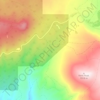
Name: The Cascades topographic map, elevation, terrain.
Location: The Cascades, Klamath County, Oregon, United States (42.22394 -122.28899 42.25038 -122.21260)
Average elevation: 1,589 m
Minimum elevation: 1,248 m
Maximum elevation: 1,929 m
Make a donation
Gear up for your next adventure:
As an Amazon Associate, this site earns from qualifying purchases at no extra cost to you.
Other topographic maps
Click on a map to view its topography, its elevation and its terrain.
Crater Lake
United States > Oregon > Klamath County
The lake is 5 by 6 miles (8.0 by 9.7 km) across, with a caldera rim ranging in elevation from 7,000 to 8,000 feet (2,100 to 2,400 m) and an average lake depth of 1,148 feet (350 m). The lake's maximum depth has been measured at 1,949 feet (594 m), which fluctuates slightly as the weather changes. On the basis…
Average elevation: 1,971 m
Klamath Falls
United States > Oregon > Klamath County
According to the United States Census Bureau, the city has a total area of 20.66 square miles (53.51 km2), of which 19.81 square miles (51.31 km2) is land and 0.85 square miles (2.20 km2) is water. The elevation is 4,094 feet (1,248 m).
Average elevation: 1,312 m