
Thank you for supporting this site ❤️
Make a donation
Make a donation
Gear up for your next adventure:
As an Amazon Associate, this site earns from qualifying purchases at no extra cost to you.
Mikrevo topographic map
Click on the map to display elevation.
Thank you for supporting this site ❤️
Make a donation
Make a donation
Gear up for your next adventure:
As an Amazon Associate, this site earns from qualifying purchases at no extra cost to you.
About this map
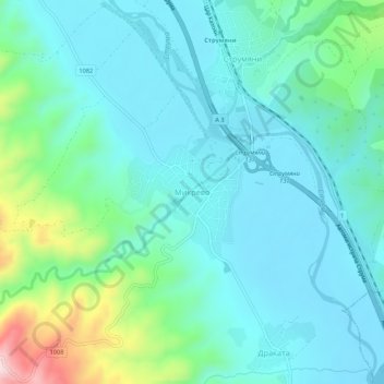
Name: Mikrevo topographic map, elevation, terrain.
Location: Mikrevo, Strumiani, Blagoevgrad, 2826, Bulgaria (41.60456 23.17516 41.64456 23.21516)
Average elevation: 184 m
Minimum elevation: 114 m
Maximum elevation: 464 m
Thank you for supporting this site ❤️
Make a donation
Make a donation
Gear up for your next adventure:
As an Amazon Associate, this site earns from qualifying purchases at no extra cost to you.