Geolocate

Piper Island topographic map

Click on the map to display elevation.

About this map

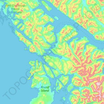
Name: Piper Island topographic map, elevation, terrain.

Location: Piper Island, Sitka, Alaska, United States (57.07104 -135.91258 57.71104 -135.27258)

Average elevation: 209 m

Minimum elevation: -9 m

Maximum elevation: 1,478 m

Other topographic maps

Click on a map to view its topography, its elevation and its terrain.

Beaver Lake

United States > Alaska > Sitka > Sitka

Average elevation: 313 m

Gear up for your next adventure:

🐕Hiking Dog Pack - Let your canine companion carry their own water and food
🦶Hiking Shoe Insoles - Added support for high arches and long days on feet
🥾Lightweight Hiking Shoes - Comfortable shoes for day hikes
🧥Softshell Hiking Jacket - The perfect balance of wind protection and breathability
🧴Outdoor Sunscreen - High SPF protection for high-altitude UV exposure

As an Amazon Associate, this site earns from qualifying purchases at no extra cost to you.