Geolocate

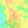
Jarratt topographic map

Click on the map to display elevation.

About this map

Name: Jarratt topographic map, elevation, terrain.

Location: Jarratt, Sussex County, Virginia, United States (36.80486 -77.48593 36.82644 -77.45668)

Average elevation: 47 m

Minimum elevation: 36 m

Maximum elevation: 52 m

Other topographic maps

Click on a map to view its topography, its elevation and its terrain.
Yale

United States > Virginia > Sussex County

Average elevation: 31 m

Homeville

United States > Virginia > Sussex County

Average elevation: 30 m

Gear up for your next adventure:

⛺Camping Groundsheet - Protect your tent from moisture and dirt
🧦Hiking Socks - Moisture-wicking and comfortable socks for long hikes
🧢Outdoor Cap - Protective cap for sun and rain during hikes
🧣Evaporative Cooling Towel - Beat the heat during intense summer climbs
🕯️Camping Lantern - Illuminates your entire campsite with high-efficiency LEDs

As an Amazon Associate, this site earns from qualifying purchases at no extra cost to you.