Geolocate

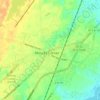
Tall PInes topographic map

Click on the map to display elevation.

About this map

Name: Tall PInes topographic map, elevation, terrain.

Location: Tall PInes, Berkeley County, South Carolina, 29456, United States (32.99017 -80.12537 33.03017 -80.08537)

Average elevation: 13 m

Minimum elevation: 2 m

Maximum elevation: 23 m

Other topographic maps

Click on a map to view its topography, its elevation and its terrain.
Ladson

United States > South Carolina > Berkeley County

Average elevation: 14 m

Ladson

United States > South Carolina > Berkeley County

Average elevation: 14 m

Gear up for your next adventure:

🥤Collapsible Travel Cup - Saves space and weight in your mess kit
🧦Merino Wool Socks - Moisture-wicking comfort for long-distance hiking
🥾Trail Hiking Socks - Comfortable socks to prevent blisters and fatigue
👟Sport Hiking Sandals - Breathable footwear for water crossings and camp rest
🧥Thermal Layer - Insulating layer for cold outdoor conditions

As an Amazon Associate, this site earns from qualifying purchases at no extra cost to you.