Geolocate

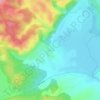
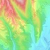
Turburea topographic map

Click on the map to display elevation.

About this map

Name: Turburea topographic map, elevation, terrain.

Location: Turburea, Gorj, Romania (44.63231 23.49161 44.75755 23.59714)

Average elevation: 210 m

Minimum elevation: 110 m

Maximum elevation: 361 m

Other topographic maps

Click on a map to view its topography, its elevation and its terrain.

Totea

Romania > Gorj

Average elevation: 333 m

Artanu

Romania > Gorj

Average elevation: 246 m

Urdele

Romania > Gorj > Novaci

Average elevation: 1,932 m

Costeni

Romania > Gorj > Tismana

Average elevation: 267 m

Costești

Romania > Gorj

Average elevation: 227 m

Bolboasa

Romania > Gorj

Average elevation: 219 m

Slăvuța

Romania > Gorj

Average elevation: 262 m

Cornetu

Romania > Gorj

Average elevation: 236 m

Rânca

Romania > Gorj

Average elevation: 1,472 m

Păjiștele

Romania > Gorj

Average elevation: 375 m

Gear up for your next adventure:

🧢Beanie Hat - Keep your head warm in cold weather
🧢Hiking Hat - Sun-protective and breathable hats for long treks
🎒Fully Waterproof Backpack - Total protection for photography gear and electronics
🧦Thermal Socks - Warm socks for winter hiking or camping
🏕️Camping Hammock - Integrated protection for sleeping between trees

As an Amazon Associate, this site earns from qualifying purchases at no extra cost to you.