Geolocate

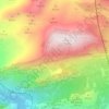
Alameda topographic map

Click on the map to display elevation.

About this map

Name: Alameda topographic map, elevation, terrain.

Location: Alameda, Antequera, Malaga, Andalusia, 29530, Spain (37.19328 -4.73575 37.25970 -4.59626)

Average elevation: 425 m

Minimum elevation: 241 m

Maximum elevation: 794 m

Other topographic maps

Click on a map to view its topography, its elevation and its terrain.
Sierra de Huma

Spain > Andalusia > Antequera > Antequera

Average elevation: 714 m

Mataliebres

Spain > Andalusia > Antequera > Mollina

Average elevation: 554 m

Cartaojal

Spain > Andalusia > Antequera > Antequera

Average elevation: 537 m

La Joya

Spain > Andalusia > Antequera > Antequera

Average elevation: 717 m

Gear up for your next adventure:

🧢Hiking Sun Hat - Wide-brimmed protection for exposed mountain ridges
🏕️Camping Hammock - Integrated protection for sleeping between trees
⛺Lightweight Backpacking Tent - Compact tent for efficient hiking trips
🧥Softshell Jacket - Windproof and breathable jacket for hiking
🥾Hiking Shoes - Durable and comfortable shoes for trail hiking

As an Amazon Associate, this site earns from qualifying purchases at no extra cost to you.