Geolocate

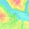
Hastings topographic map

Click on the map to display elevation.

About this map
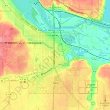
Name: Hastings topographic map, elevation, terrain.

Location: Hastings, Dakota County, Minnesota, 55033, United States (44.70231 -92.90032 44.77490 -92.81252)

Average elevation: 241 m

Minimum elevation: 202 m

Maximum elevation: 295 m

Other topographic maps

Click on a map to view its topography, its elevation and its terrain.

Hastings

United States > Minnesota > Dakota County

Average elevation: 243 m

Hastings

United States > Minnesota > Dakota County

Average elevation: 243 m

Empire Lake

United States > Minnesota > Dakota County

Average elevation: 277 m

Gear up for your next adventure:

🎒Fully Waterproof Backpack - Total protection for photography gear and electronics
⛺Camping Essentials - All-in-one gear for a comfortable camping trip
🧼Travel Hand Sanitizer - Keep hands clean when water is scarce
🥾Durable Hiking Shoes - Long-lasting shoes for frequent hiking
🦌Outdoor Trail Camera - Monitor wildlife activity near your favorite spots

As an Amazon Associate, this site earns from qualifying purchases at no extra cost to you.