Geolocate

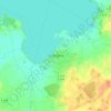
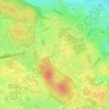
Rappestad topographic map

Click on the map to display elevation.

About this map

Name: Rappestad topographic map, elevation, terrain.

Location: Rappestad, Linköpings kommun, Östergötland County, 583 91, Sweden (58.38145 15.40069 58.42145 15.44069)

Average elevation: 78 m

Minimum elevation: 66 m

Maximum elevation: 95 m

Other topographic maps

Click on a map to view its topography, its elevation and its terrain.
Knabben

Sweden > Östergötland County > Norrköping

Average elevation: 45 m

Vadstena

Sweden > Östergötland County

Average elevation: 98 m

Mjölby kommun

Sweden > Östergötland County

Average elevation: 123 m

Navestad

Sweden > Östergötland County > Norrköping

Average elevation: 34 m

Nässja

Sweden > Östergötland County

Average elevation: 91 m

Illern

Sweden > Östergötland County > Linköping

Average elevation: 72 m

Kinda kommun

Sweden > Östergötland County

Average elevation: 133 m

Halgen

Sweden > Östergötland County

Average elevation: 88 m

Gear up for your next adventure:

🥾Approach Shoes - Shoes designed for climbing approaches and rugged trails
🧊Portable Cooler - Keep food and drinks cold during outdoor adventures
🥾Light Hiking Boots - Lightweight and comfortable boots for day hikes
🧭Orienteering Kit - Tools for map reading and navigation in the wild
🥤Collapsible Travel Cup - Saves space and weight in your mess kit

As an Amazon Associate, this site earns from qualifying purchases at no extra cost to you.