Geolocate

Potton topographic map

Click on the map to display elevation.

About this map
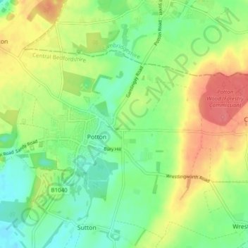
Name: Potton topographic map, elevation, terrain.

Location: Potton, Central Bedfordshire, England, United Kingdom (52.11630 -0.23801 52.14477 -0.16179)

Average elevation: 52 m

Minimum elevation: 26 m

Maximum elevation: 85 m

Gear up for your next adventure:

⛺Camping Groundsheet - Protect your tent from moisture and dirt
🥾Mountain Hiking Shoes - Shoes with superior grip for mountainous terrain
🛶Kayak Accessories - Essential gear for safe and fun kayaking adventures
👖Convertible Hiking Pants - Zip-off legs to adapt to changing weather conditions
🥾Hiking Gaiters - Protect legs and shoes from mud, snow, and debris

As an Amazon Associate, this site earns from qualifying purchases at no extra cost to you.