Geolocate

Rättvik topographic map

Click on the map to display elevation.

About this map

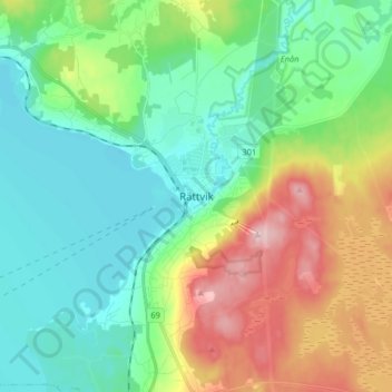
Name: Rättvik topographic map, elevation, terrain.

Location: Rättvik, Rättviks kommun, Dalecarlia, RÄTTVIK, Sweden (60.84375 15.08268 60.92375 15.16268)

Average elevation: 225 m

Minimum elevation: 158 m

Maximum elevation: 374 m

Gear up for your next adventure:

🥾Hiking Gaiters - Protect legs and shoes from mud, snow, and debris
🥾Trekking Boots - Durable boots for long-distance trekking
Tent Footprint - Protect tent floor and increase durability
🥾Hiking Shorts - Breathable shorts suitable for summer hikes
🧰Multitool Knife - Compact and versatile tool for outdoor use

As an Amazon Associate, this site earns from qualifying purchases at no extra cost to you.